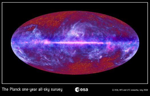
ESA has released images of the first all-sky survey from the Planck space observatory, which is currently in orbit around Lagrange-2, a balancing point between the gravitational exertions of the moon and the earth.
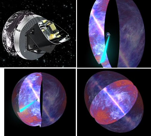
Planck rotates at a constant 1 RPM, and it continually repositioned to avoid the sun, enabling it to produce a full survey of the entire sky in about a year. This computer animation video demonstrates how the survey image was constructed:
When Planck’s data is added to the American Museum of Natural History’s Digital Universe Atlas, it should help fill in that gigantic torus marked, “empty areas we have yet to map.”
Planck all-sky image depicts galactic mist over the cosmic background [esa.int via javierest]
Scanning the microwave sky with Planck [esa.int]
Skip to content

the making of, by greg allen