Not since we programmed it into the navigation system of my in-laws’ car, anyway.
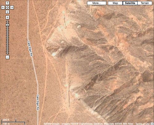
The car also has an offroad navigation feature that logs virtual GPS breadcrumbs at preset intervals along the way, but it proved unnecessary. The nearly featureless mesa where Heizer’s land artwork is sited turns out to be a road with a name: Carp Elgin Rd.
In fact, there it is on Google Maps, one of the tightest satellite shots I’ve ever seen of Double Negative. Crazy.
Update: OK, not to get all George Bush and the Grocery Scanner about it, but I just typed “Spiral Jetty” into Google Maps, and it came right up. With an upgraded photograph–and a label.
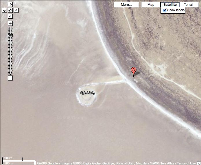
In fact, here are complete driving directions to the Jetty from 213 Park Avenue South, the former location of Max’s Kansas City. [note: there is a weird little, unnecessary jog at the very end that I couldn’t fix, but I’m not worried. Given the rate at which technology is iterating and altering the way once-isolated land artworks are experienced and perceived, I expect a realtime Google Streetview of the Jetty is already being planned on a whiteboard somewhere in Mountain View.]
Clearly, Google has been augmenting its map search with information found on the rest of the web. An otherwise seemingly Googleproof project like Michael Heizer’s City, which he sited as remotely as he could, is pinpointed by latitude and longitude coordinates published on a Land Art site. City also has newer photos.
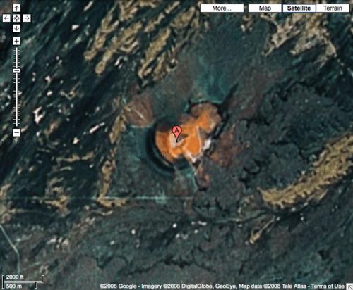
Roden Crater’s there, under “Roden Crater, AZ,” but it still has the quaint, old-timey satellite photo from 2005 or whatever. I hope they’ll get around to upgrading it by the time Turrell finishes.
Skip to content
the making of, by greg allen