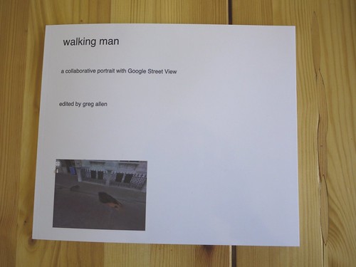
Here’s the introductory text I wrote last Spring for Walking Man – A Collaborative Self-Portrait With Google Street View. I made some proofs, but I’m still figuring out the best size. If I do decide to publish it, I may polish up the title a bit.
And I’ll probably revise it. Street View’s imagery and technique seems to me to turn a lot of critical thinking about photography on its head, but as much as the theoretical implications fascinate me, every time I start writing about them, I feel like a poseur.
As ongoing enhancements and even promotional stunts like Google Art Project affirm, Google executives are working to make Street View the primary tool for us “visual animals,” a browser for the physical world. Robert Smithson wrote about studying massive infrastructures like dams to discover “unexpected aesthetic information.” Google is creating the most massive visual infrastructure project right now, and it is chock full of unexpected visual information.
Walking Man text, April 2010
When Google began sending cars equipped with computer-controlled panoramic cameras and GPS into major US cities to collect photographs for their Google Maps’ Street View service in 2007, the vehicles went largely unnoticed or unrecognized. Millions of people were photographed unknowingly as they walked along public streets, or sat in their cars, or in their yards and homes. Google sought to alleviate privacy concerns by developing software that automatically detected and blurred out human faces and car license plates. This feature was first implemented in 2008 in the Street View photos of New York City.
By 2009, Street View was wildly popular, if not entirely uncontroversial. Even unmarked, their camera cars drew attention on the streets as they passed. And the ambitious scope of Google’s project became clear: to photograph the entire world. As Street View expanded beyond the United States, Google abandoned its “shoot first, answer questions later” strategy. Instead it leveraged the anticipation of its photosurveys by promoting them in advance. In some cases, the company even held contests, asking the public to vote on which sites would be mapped into Street View first.
Such is the case with the Netherlands. Amsterdam and Rotterdam first appeared in Street View in March 2009. The following summer, Google announced plans to photograph 20 additional Dutch cities, some with the help of the Google Street View Trike, a friendly-looking, human-powered, surveying vehicle which could navigate plazas, parks and other pedestrian zones. To mitigate any potential opposition or public complaint, Google revealed that the Street View Trike had, with official permission, already photographed the Binnenhof, the courtyard complex in The Hague which has been the seat of then Dutch government for nearly 800 years.
It is somewhat ironic that Street View provokes privacy and surveillance anxieties; from Google’s perspective, the people captured in the company’s photographs are incidental, or even an obstruction, to the more permanent–and more monetizable–geospatial information that is their primary objective. Who shows up in Street View photos is as irrelevant as when, exactly, they were taken. Such perishable, ephemeral content can only detract from Google Maps’ universal utility; it is noise in the data that needs to be scrubbed and cleaned out.
Which makes the actions of one young man in the Street View Binnenhof survey all the more remarkable. That summer morning, as the Google Trike was checking in at the Binnenhof security gate a man–from his tank top, jeans, and pocket camera, he appears to be a tourist–recognized the Trike and understood its mission and decided to tag along.
He walked alongside the Trike the entire way, persistently inserting himself into the foreground of multiple Street View cameras at all times; he turns up in nearly every panorama Google created at the Binnenhof and on the surrounding streets. In the process, he transformed Google’s vast photomapping venture into his personal portrait studio and travelogue. We may not know who this walking man is, but anyone using Google Maps now knows what he did last summer.
Through this seemingly inconsequential act–walking around–the man ends up revealing the invisible contours of Google’s project: Street View’s little-recognized spatial and temporal distortions of the physical world; the algorithms and automated processes designed to thwart the man’s dogged assertions of his own, individual presence; and the company’s own attempts to insert itself in between us all and the world in which we live.
To survey the Binnenhof, the Google Street View Trike used a 4th generation photo capture and logging system which comprised nine near-HD quality cameras on a 2.5-meter stalk and a GPS locator, all controlled by an onboard computer.
Though it appears continuous, Street View’s imagery is actually made up of a series of 360-degree panoramas generated for specific geospatial points along the vehicle’s route. Each panorama is stitched together into an equirectangular grid using the 21 clearest photos for that specific site. If a photo contains a transitory obstruction–a delivery truck, for example, or the proximate body and head of a flâneur–it is automatically swapped out for another image depicting the same coordinates, which was taken a few meters–and a few seconds–before or afterward. This introduces unusual, cubistic distortions; a single panorama is often an algorithmically generated pastiche of images taken from multiple vantage points and moments in time.
The typical Street View image seems to exist in a perpetually instant present. There are no time stamps to indicate when the
photos were taken, and the user’s simulated movement through panoramas conveys no sense of the passage of time; nothing else moves, and there is no beginning or end. By constantly inserting himself into the Binnenhof photos, the walking man provides a rare point of reference, an identifiable marker for tracking the Google Trike’s operation. Most radically, he provides Street View with a subject–himself–and a narrative–his journey. His inadvertent co-star is the Trike–and by extenion, Google’s gaze itself.
A close analysis of the panoramas shows the walking man first waited for the Trike to clear the Binnenhof’s traffic barrier. Then he walked alongside it as it entered the Stadtholder’s Gate and circumnavigated the Ridderzaal, or Knights’ Hall, where the Queen addresses Parliament. There is a noticeable jump where the Trike doubled back over its path. One panorama in front of the Mauritshuis Museum clearly contains two temporally disparate images of the walking man–one of him waiting for the trip to begin, and another of him walking alongside the Trike as it leaves the complex. They both turn onto Korte Vijverberg, the tree-lined street which runs alongside the Binnenhof’s manmade pond, the Hofvijver. The Trike turns onto the bike lane of the Lange Vijverberg, and the man keeps up until, unexpectedly, in the middle of the block, he disappears without a trace.
Hewing closely to the Trike as it maintained its steady, rectilinear trajectory, the flâneur plotted his own freeform course. He occasionally continued ahead or lagged behind, and and he switched from one side of the Trike to the other.
Whether he knew it at the time or not, his proximity to the cameras put the flâneur at cross purposes with Google’s automated, panorama generation scripts. The optimization software read his looming presence as an anomaly, and he is repeatedly obscured, all but his disembodied head or even just his hair, by large, lozenge-shaped patches of cobblestones. The more he asserts his presence in the photographic frame, the more pronounced is the Street View’s system attempts to erase him from the images.
His actions in the final panoramas lend themselves to speculation: In his penultimate appearance, walking man becomes pointing man; he is seen gesturing across the plane, breaking the fourth wall, as it were, by addressing the Google Trike driver himself.
Perhaps this crossed a line about the presumption of passivity for Google’s photographic bystanders. Or maybe it violated some rule of non-engagement, a Street View Prime Directive. Is it possible that he’d been talking with the Trike rider, his personal camera operator, all along?
A closer review of panos from other Google Trike deployments suggests the former. A similar figure appears intermittently in Street View’s absurdist map of the labyrinthine garden paths of the 17th century Dutch Kasteeltuinen Arcen. A Google Grip, he opens gates and moves benches to clear the Trike’s path.
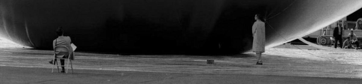
And in a very early and revealing test run at the Santa Monica Pier, the Google Trike actually has a posse. Two men, first positioned almost like bodyguards, at 10 and 2 o’clock, walk ahead of the Trike [1], which was presumably driven by its inventor, Google Senior Mechanical Engineer Dan Ratner. When a tourist happens upon the unusual trike the men move out of the frame of his souvenir photograph. And yet, in another pano, one of the men is seen leaning against the railing, posing as a bystander–and waving to the camera.